
A Stroll Through the Ghetto
Poland has come a long way in presenting the sites of the Nazi-led genocide against the Jewish people during World War II. The Auschwitz-Birkenau extermination camp, of course, has been a memorial and museum for decades now, but it wasn’t all that long ago that visitors were more or less on their own to locate many of the lesser-known camps or find the wartime ghettos the Germans built in several Polish cities to gather Jews before they were transported to the death camps.
These days, tourist offices in cities like Warsaw, Łódź and Kraków are accustomed to visitors asking about sites related to the Holocaust and have opened up some excellent museums --- such as Kraków’s Schindler’s Factory or Warsaw’s Museum of the History of Polish Jews -- to help tell that story. I’ve written here previously about these promising developments in the post “Editing Out the Holocaust” -- even as Poland has tripped over itself the past year with a new law that effectively muzzles historians and others from telling the whole story of the Holocaust.
As good as the new museums are, though, something gets lost in translation when history is reduced to a glass panel in an exhibition room. The fact is four decades of Communist rule in Poland effectively froze the events of modern history, including the Holocaust, in amber, leaving whole sections of cities essentially unchanged from how they were 80 years ago. That gives visitors a unique opportunity to supplement their museum visits with a walk through the areas where the horrific events actually took place.
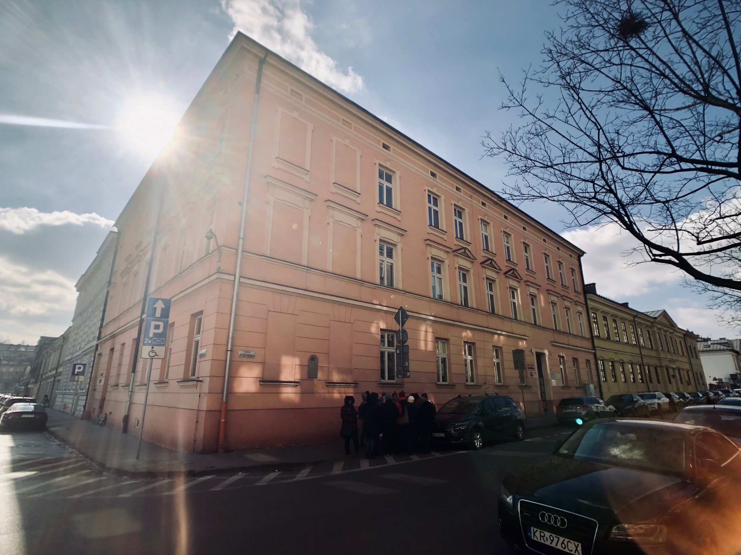
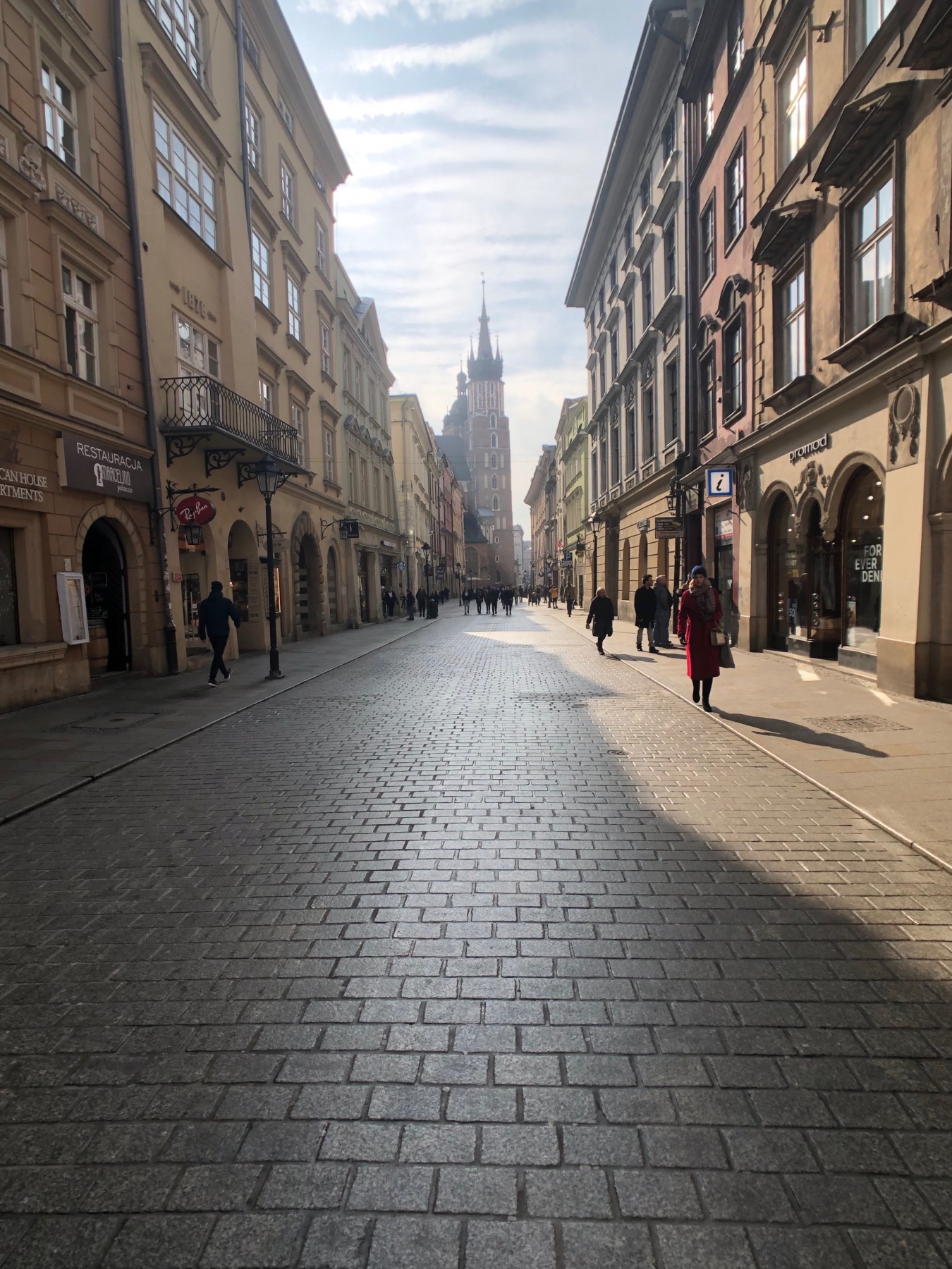
In Kraków, the Holocaust played itself out on the southern side of the Vistula River in the suburb of Podgórze. This was where the Nazis built their guard-towered ghetto and rifle-marched 16,000 Jews in March 1941 to live in squalor before they could be sent off to their deaths at the Bełżec extermination camp or to work as slaves at Płaszów, a few miles down the road. The ghetto survived for two years, before it was violently liquidated in March 1943. Though the Podgórze district has seen an economic revival the past few years, much of the former ghetto still feels depressed. To transport yourself back to the 1940s, all you need to do is squint your eyes and add in a layer of sepia-tone.
And that’s what I did on a sunny Saturday afternoon in early March, when I took a stroll through the former ghetto.

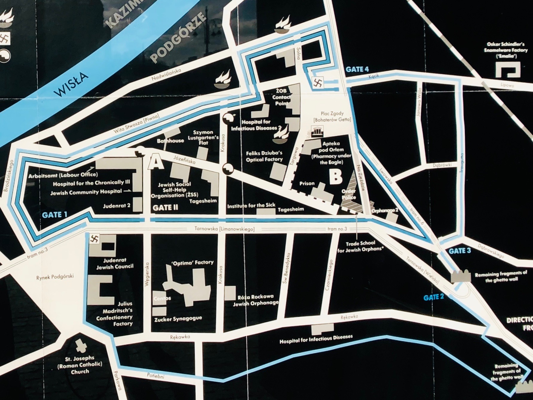
By coincidence, when I first planned my research trip to Krakow, I booked an Airbnb that happened to lie along the northern border of the former ghetto, on Nadwiślańska street. I discovered this after looking at the ghetto map (see the photo, above) posted on a wall at the northern end of Plac Bohaterów Getta, the logical point for starting a tour of the area. I didn't have far to walk to begin my exploration.
Plac Bohaterów Getta translates as "Heroes of the Ghetto" square, but during the Nazi occupation, Plac Zgody (as it was called then) was the first part of the ghetto the city's Jewish population would enter as they were forcibly relocated across the Vistula in 1941. As the largest open area in the ghetto, the square served as a mustering ground for ghetto residents who were called out for systematic deportations in 1942 to the extermination camp at Bełżec, in southeastern Poland. During the final liquidation of the ghetto in March 1943, the remaining residents were required to assemble here before being sent away to their deaths. The oversized, empty chairs that stand on the square today form an art installation that represents ghetto residents who are no longer with us.
The ghetto was compact, covering only a few blocks of this part of Podgórze. Nothing is more than 10 or 15 minutes' walk away. Before leaving the square, I took a peek inside the former "Pharmacy under the Eagle" (Apteka pod Orłem) on the square's southern end. Run during World War II by a Roman-Catholic Pole, Tadeusz Pankiewicz, the pharmacy dispensed medicines to help the ghetto's residents and aided in the anti-Nazi resistance. Pankiewicz was later recognized by Israel as a "Righteous Among the Nations."
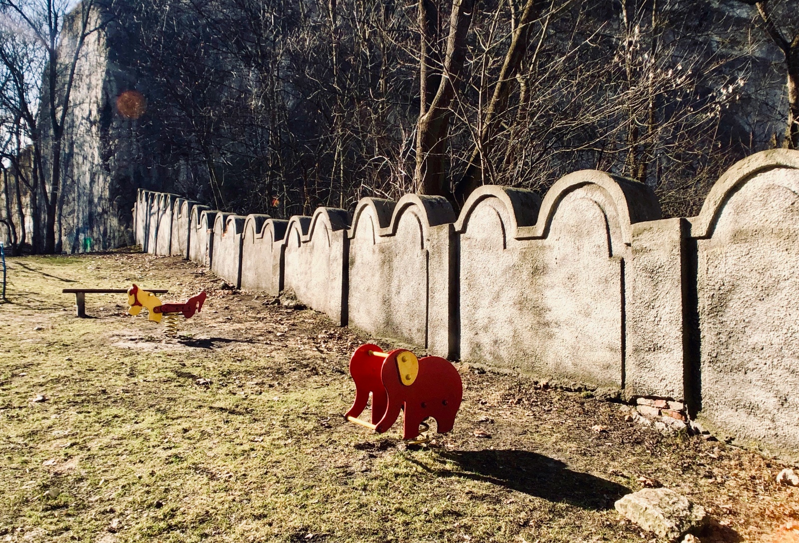
Astonishingly, you can still see surviving fragments of the ghetto walls at two locations: Lwowska street 25-29, southeast of Plac Bohaterów Getta, and at Limanowskiego street 62, where the wall cuts incongruously through a children's playground.
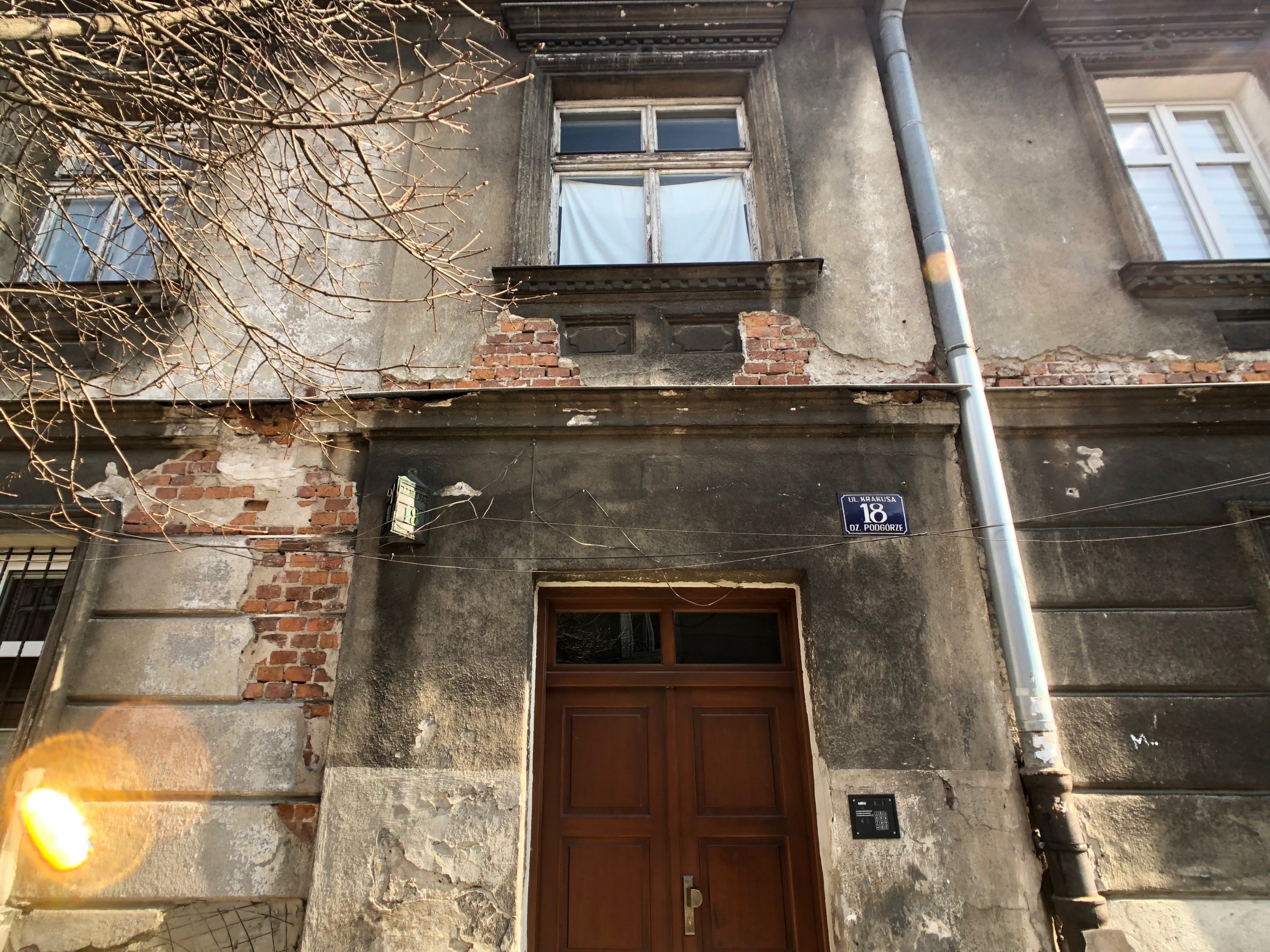
My own tour was completely haphazard, but I'd recommend simply doing as I did, snapping a photo of the ghetto map with your phone and wandering at will. As I walked and looked up at the crumbling buildings along streets like Józefińska and Krakusa -- structures that were clearly part of the old ghetto -- I tried to listen for the stories that the walls and windows must still be hiding all these years later.
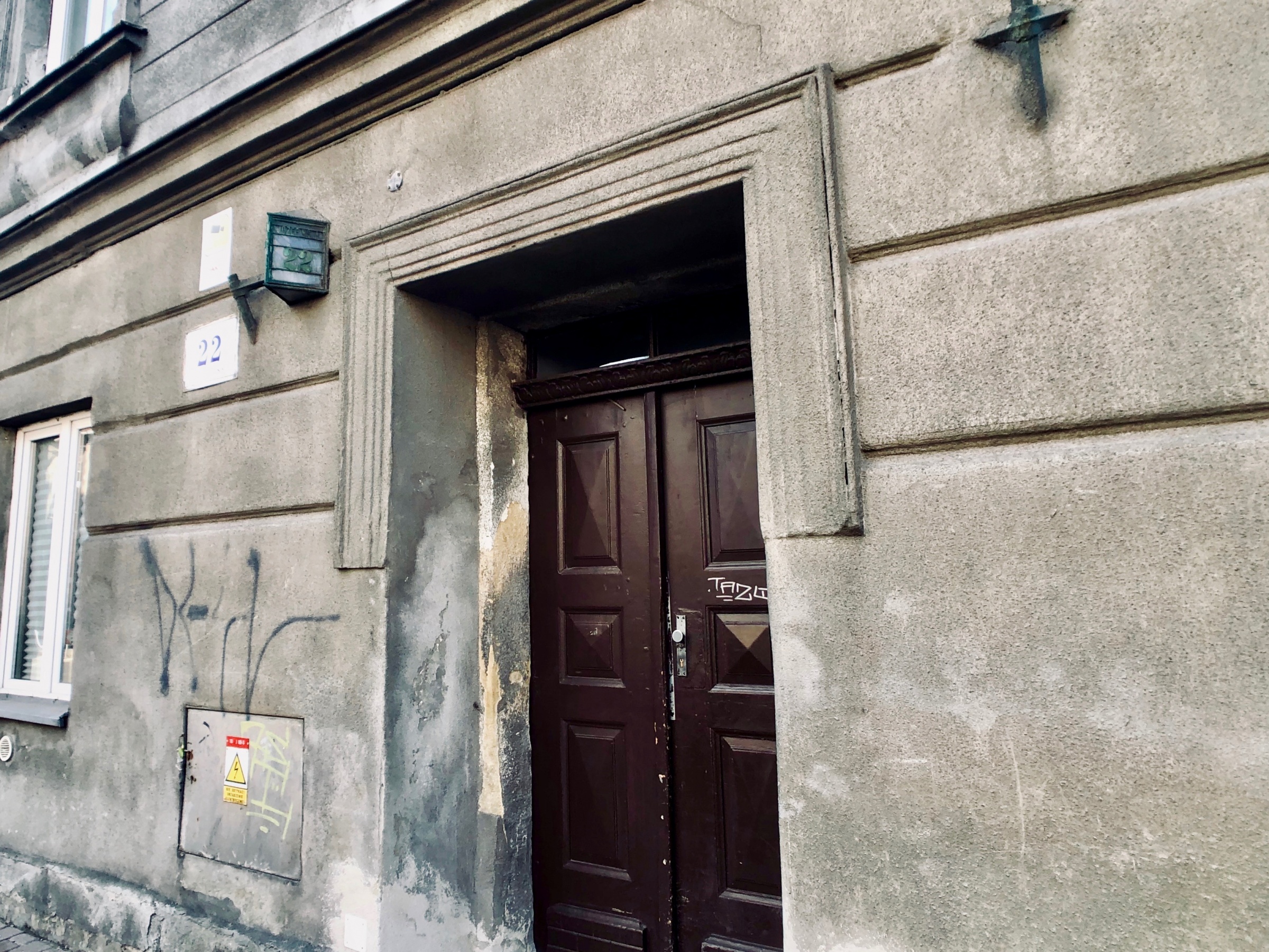
One of those stories took place at Józefińska street 22, the site today of a derelict, nondescript building that hundreds of people walk past every day without giving it a second thought. During the ghetto years, this structure served as a day-care for Jewish children. On that fateful day in March 1943 when the ghetto was cleared once and for all, rather than waste the energy it would have taken to push the kids onto the trains, the Nazis chose instead to kill them on the spot.

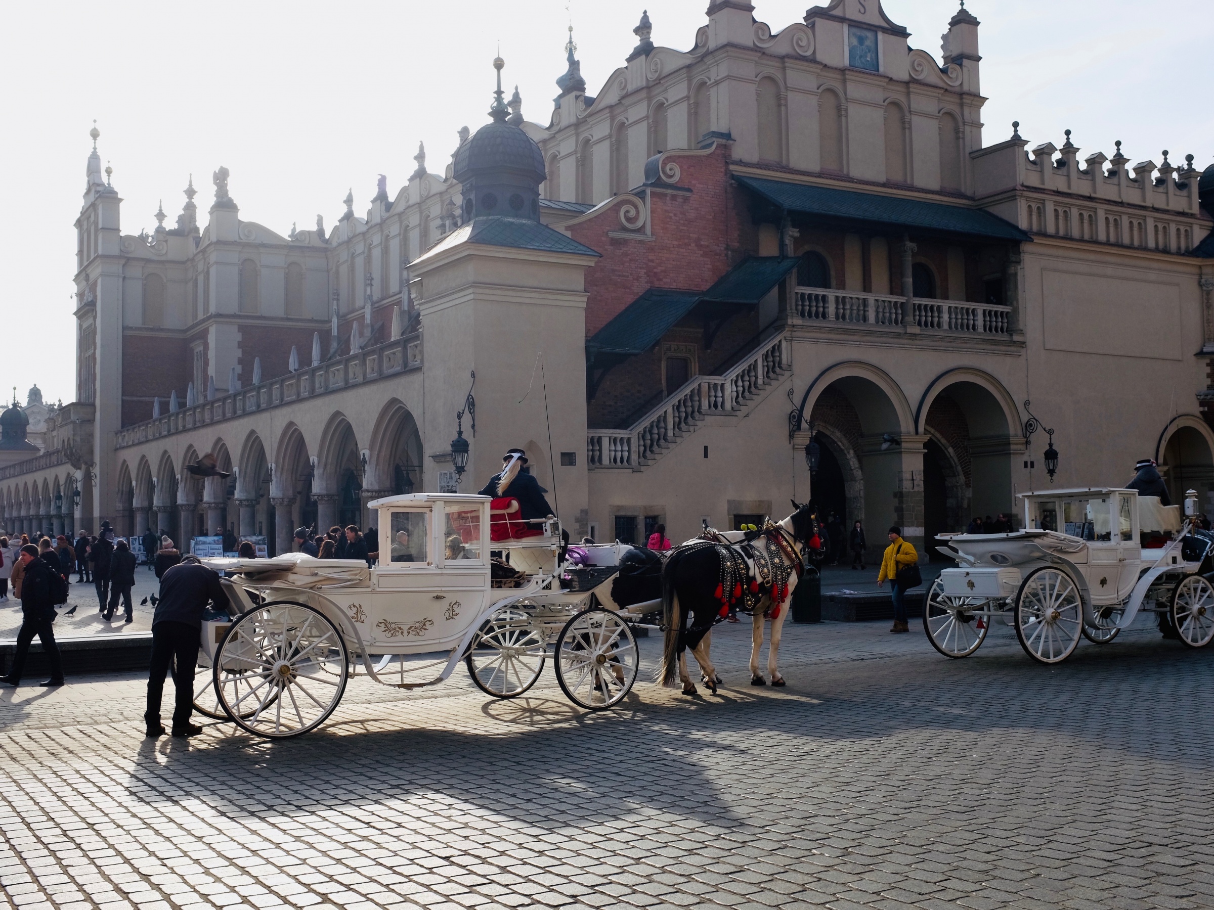
Magnificent Main Square
As a person who lives in Prague, with its fabled Old Town Square, it’s a little disconcerting to visit a sister city like Kraków that -- in my opinion -- has possibly an even nicer square. Well, let’s be frank here. It might not only be nicer, it might actually be a lot nicer -- bigger, prettier, more interesting and more livable. Stop me when you disagree.
Obviously, Prague has lots of amazing assets that Kraków lacks -- let’s start with Charles Bridge -- and it’s a fool’s errand, anyway, to compare the two cities. They’re both great. My point is not to pick a fight with my Prague friends, but rather to highlight the unique symmetry and balance of Kraków’s masterful Rynek Główny.
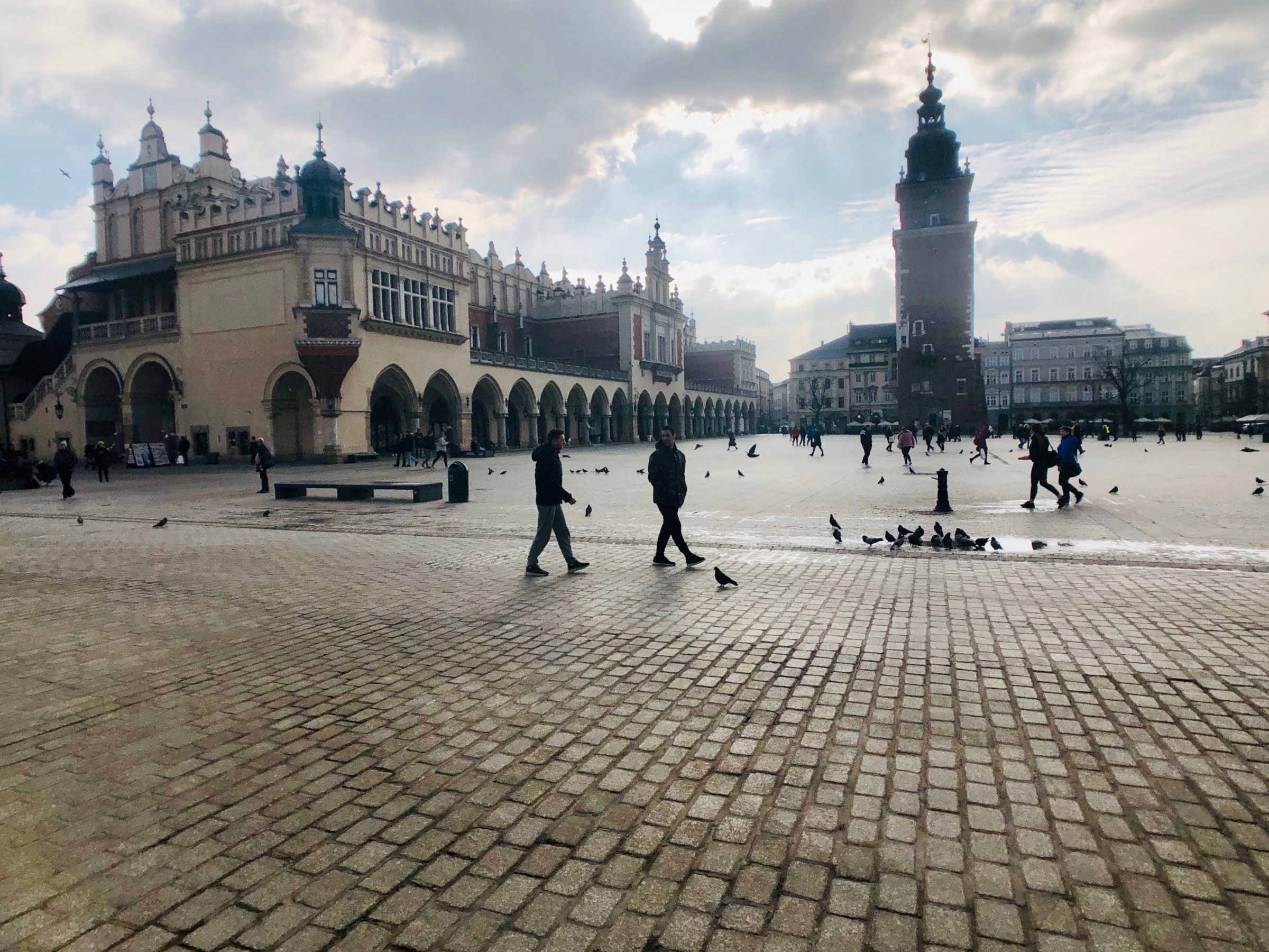
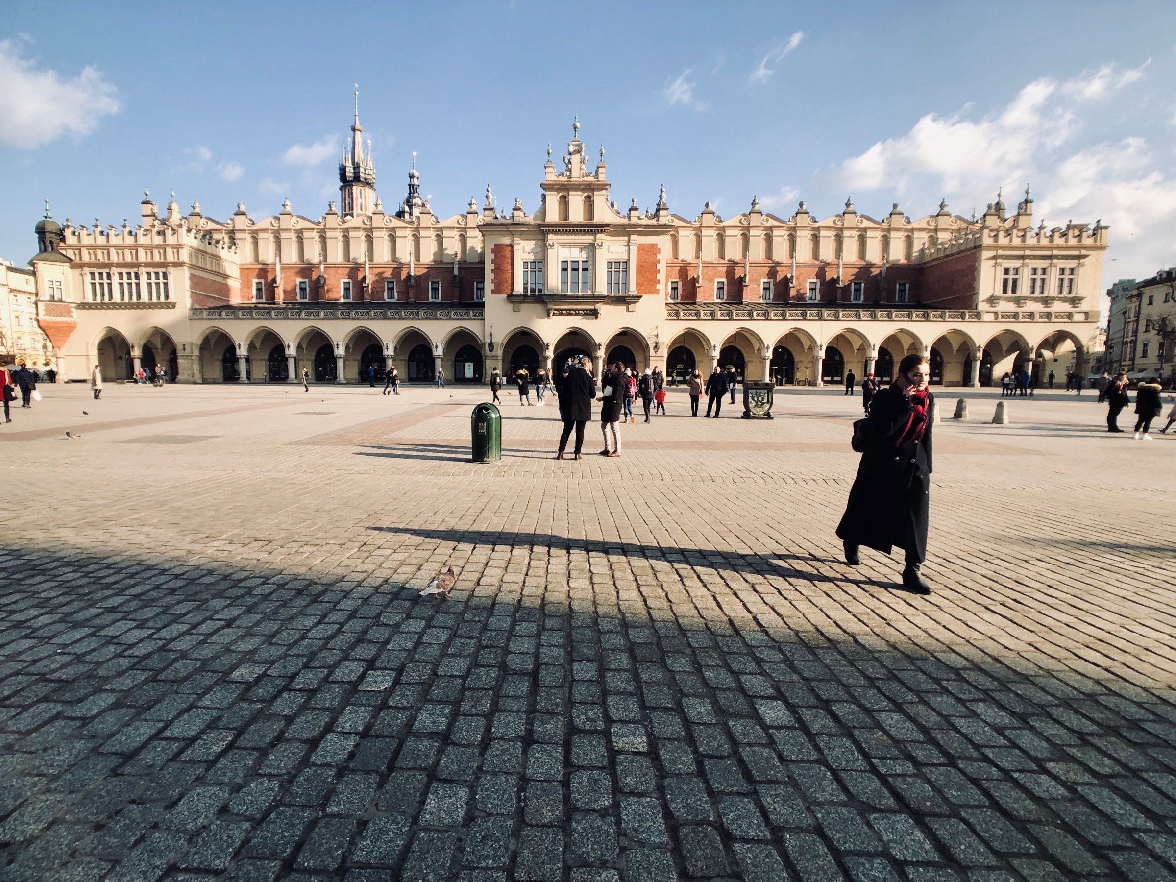
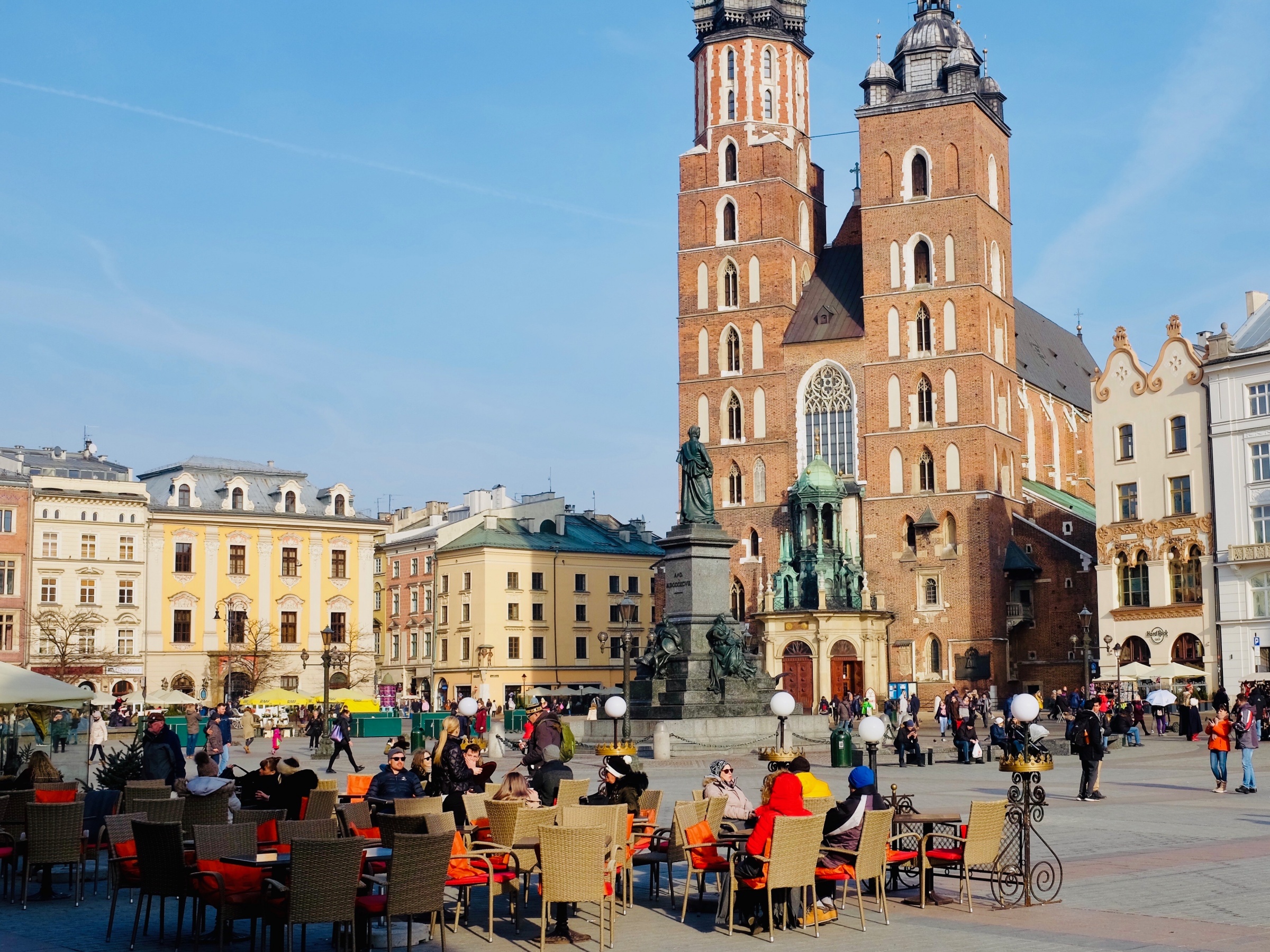
I know the Rynek Główny was laid out back in the 13th and 14th centuries, but it’s hard not to see at least a bit of its 16th-century Renaissance perfection, as it was remodeled in later centuries. It's a nearly perfect 200m x 200m square, dotted in the center by the Cloth Hall (Sukiennice), which is itself a masterpiece of Renaissance architecture.
Kraków was the capital of the Polish kingdom throughout nearly all of the 16th century, when Poles went nuts for Renaissance town planning -- the kind being pioneered at the time mainly by the Italian masters. The basic idea behind Renaissance planning was that aesthetic “laws” -- much like the laws of physics -- could be expressed in the form of physical dimensions. Buildings would be built to certain heights, and streets and squares to certain widths, so as to respect proportion and to maximize beauty. Perfection could be measured and created at will by architects who understood and respected the mathematical code.
Whole cities, like Zamość in the southeast of the country, were built around Renaissance principles, and I’ve always been a little bit skeptical of the basic ideas. One big drawback for me was that the Renaissance masters seemed to design their squares and buildings with little regard to how people actually lived. By that I mean that the math came first and the people second.
It always seemed to me more natural for towns and cities to expand organically -- and not strictly from the drawing board or the slide rule. Didn’t socialist planners during Communist times run into all sorts of issues trying to force people into idealized structures that didn’t always conform to real life?
Anyway, I think a strong case can be made that in Kraków, at least, that pursuit of perfection has paid off. The main square's long, straight sides create reams of retail capacity for cafes, restaurants and clubs of all sorts to thrive, while the vast spaces within the square can hold even modern, Instagram-driven levels of visitors without feeling uncomfortably cramped. On every visit to the city over the years, I’ve always been struck by Kraków's “just so” feeling -- as if everything has its proper place -- and I think that feeling starts with the design of the square itself.
*Here's a link to the Lonely Planet book I am updating on this trip. The new edition is due out by the end of the year. Click here to see more of my photos on this trip.